This 8 mile Peak District walk starts from the village of Longnor.
Start: SK 08872 64926 – SK17 0NT
Map: Landranger 119, Explorer OL24
Difficulty: 12
Refreshments : Longnor and Earl Sterndale

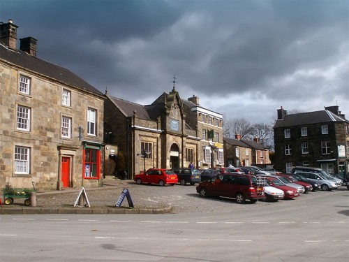
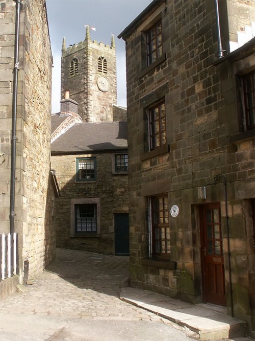
This Peak District walk starts from the market square in the village of Longnor. Longnor is set high on the Staffordshire Moorlands between the river’s Dove and Manifold. Visitors might recognise the village, famous as a location in series 12 of Peak Practice, a television series shown on the BBC between 1992 and 2002.
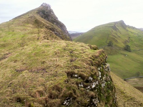
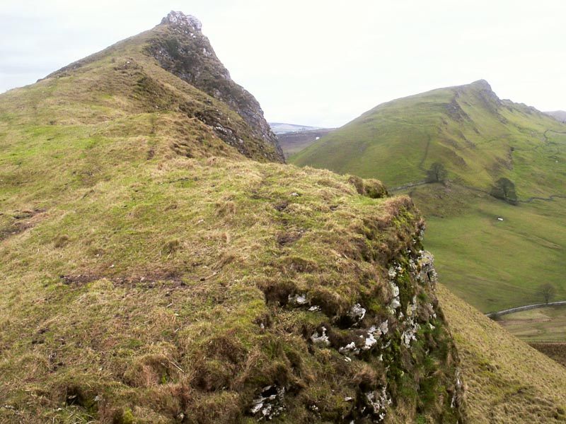
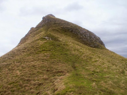
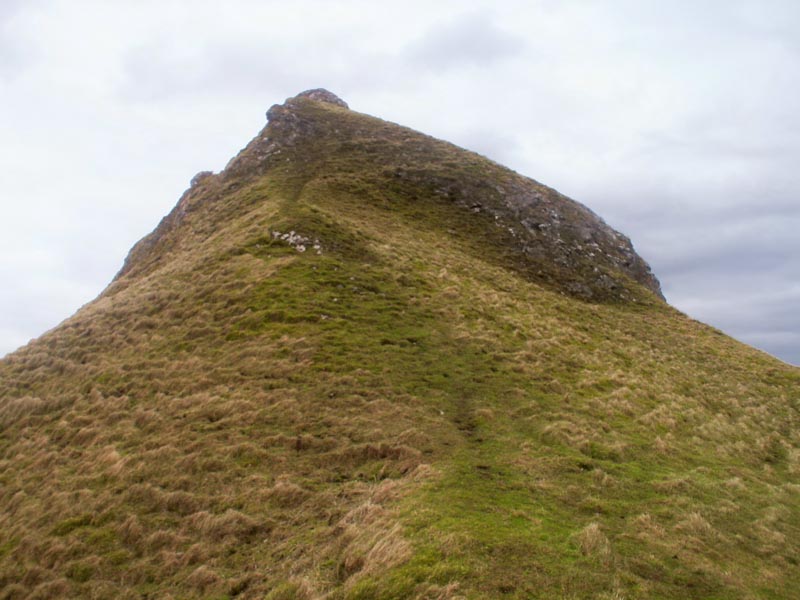
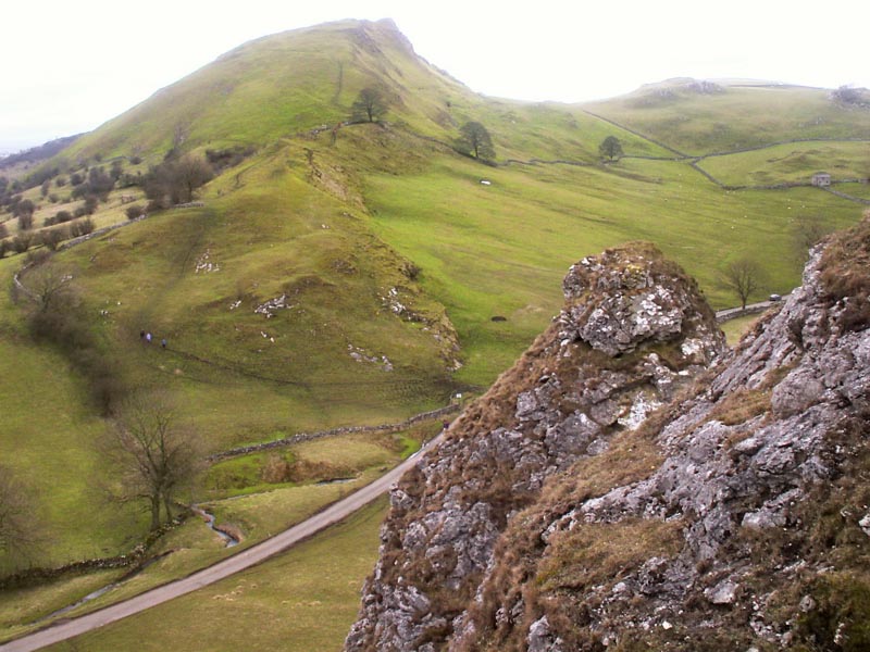
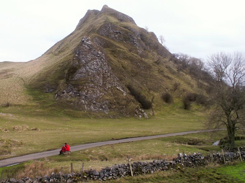
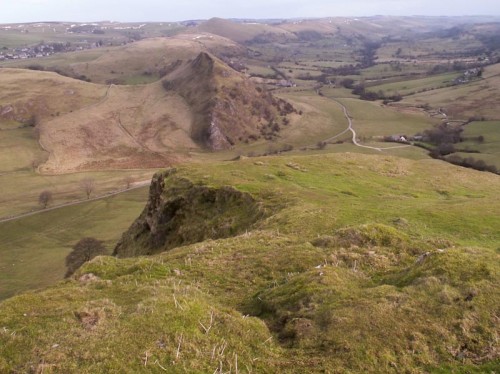
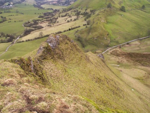
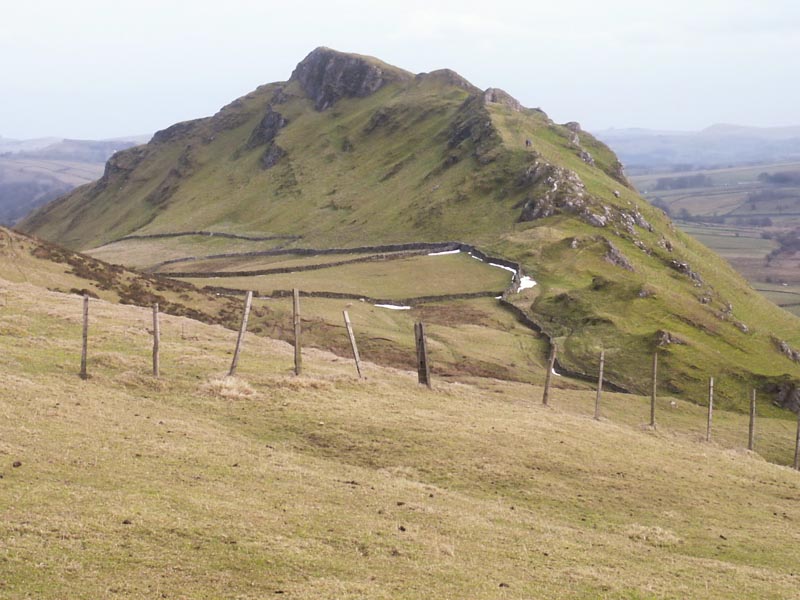
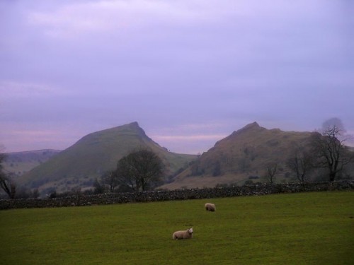
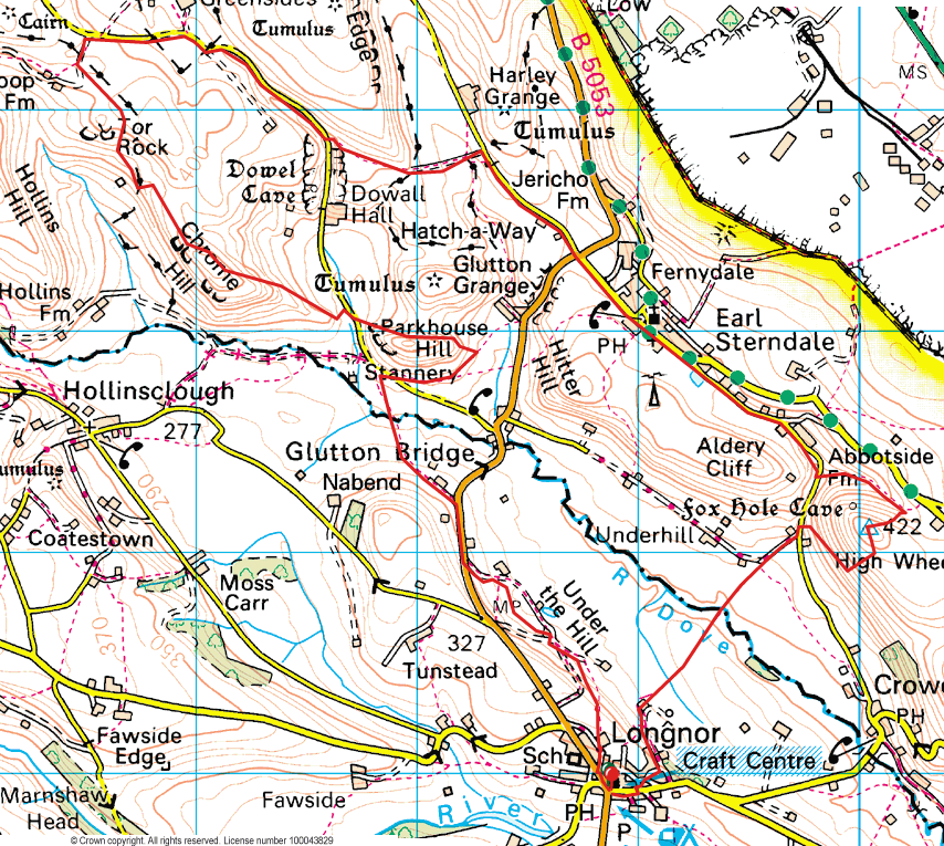
The suggested origin of the word ‘peak’ comes from the word Pecsaetans meaning hill dwellers, a tribe of people who lived here in the 7th Century. Although guidebooks may tell you there are no peaks in the Peak District, Parkhouse Hill & Chrome Hill are indeed peaks rising to over 1000ft. At one time access to Parkhouse and Chrome Hill was difficult as there was no right of way over them. Both hills are now designated Access Land under the Countryside and Rights of Way Act 2000. Parkhouse and Chrome Hills are the remains of a reef knolls from when a tropical sea covered the Peak District. Parkhouse Hill is the more distinctive of the two rising to over 1000ft with a fair bit of exposure on the ridge path to the summit. Chrome Hill is the higher of the two hills rising to 1394ft, the ridge to the summit is wider and doesn’t present any technical problems. There are extensive views south back to Longnor and down the Dove valley.
Peaks of the Peak – Chrome & Parkhouse Hill Photo Gallery


Peaks of the Peak – Chrome & Parkhouse Hill Walk Directions
The walk starts from the village of Longnor, from the market square walk up Chapel Street to Church Street turn left here and immediately right along Head Lane. Turn right here over a bank and onto a footpath that descends down the hillside. Turn left uphill onto a track away from Underhill Farm and where the path forks keep to the right, the path is vague at first but soon becomes more distinct. Follow this through Yew Tree Grange Farm and up onto the Longnor – Buxton road.
Turn right down the B5053 and then left along a lane and through a stone stile onto open pasture. Follow this footpath across pasture to a wooden footbridge over the Dove. Cross the Dove and follow the path to a road beneath Parkhouse Hill. Parkhouse Hill was classed as Open Access land on 19 September 2004.
Cross the road and contour to the right around Parkhouse Hill slowly gaining height, turn left up the ridge and onto the summit. Follow the ridge and descend over or around the pinnacles to Dowel Dale. The descent here can be quite slippery and is not without a certain amount of exposure. There are a number of easier routes off the hill to the NW, but if you’re not comfortable with this route return the way you came.
At the foot of Parkhouse Hill turn right then immediately left over a stile and ascend Chrome Hill. Follow the ridge down from the summit and follow the way marked path to Tor Rock. The path then joins a gravel track above Stoop Farm. Turn right here and right again down a lane into Dowel Dale.
After 3/4 of a mile take the way marked path on the left that takes you over fields to a lane below Harley Grange, turn right along the lane and into Earl Sterndale. Where the road forks keep to the right past the Dew Pond to the base of Aldery Cliff. Here turn left onto a path the rises slowly around High Wheeldon, at the meeting of paths turn right and ascend to the summit trig point. From the summit head south to the boundary fence follow this down the hill and around to the right eventually reaching the stile below Aldery Cliff.
Turn left along the road and then right down a walled track, where the track bears right go over a stile and descend to Beggar’s Bridge and cross the River Dove. Follow the well walked path to a barn at the foot of a concreted track. Turn left here up the hill back to Longnor.
Copyright © Peter Cox. All rights reserved