The landscape of Cheshire and the South West Peak is similar to the Dark Peak it consists of open moorland, gritstone edges, upland pasture and deep valleys notably the Goyt Valley with its two large reservoirs – Fernilee and Errwood. The very rare Killarney fern and lesser butterfly orchid are to be found in this area of the Peak District, wildlife to look out for include the lapwing, curlew and snipe.
A walk along the isolated gritstone edge known as The Roaches is a popular walk in the South West Peak, coupled with a visit to Lud’s Church a mysterious chasm deep in Back Forest makes for an exciting days walking.
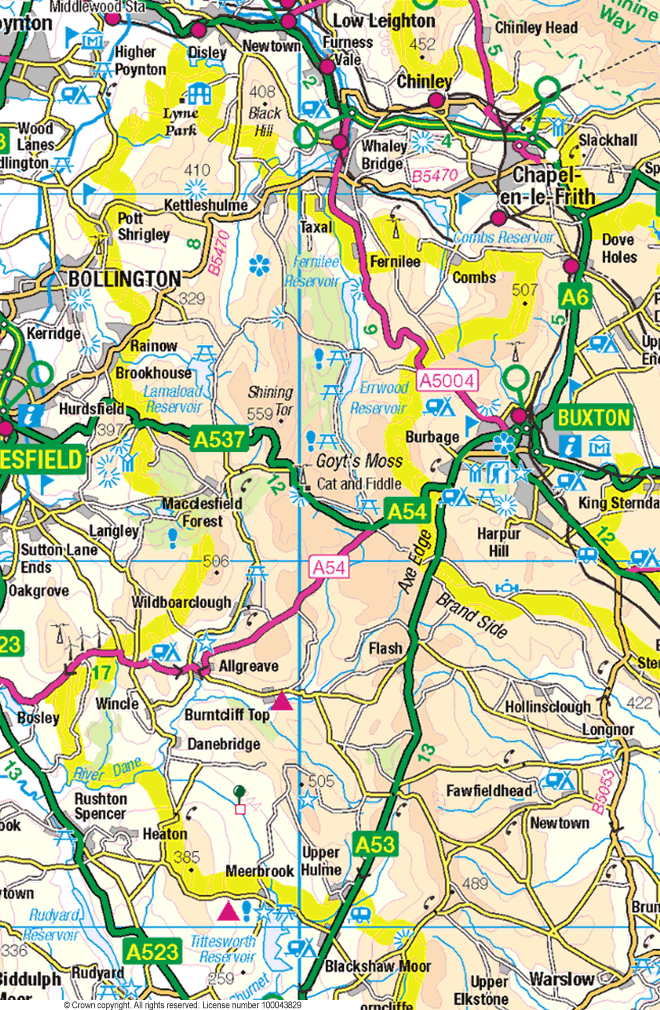
Peak District Map – South West Peak
The Peak District walks linked via this interactive map of Cheshire and Staffordshire are rated for difficulty. This rating is purely for comparison based on the length of the walk and total height climbed. The blue dots indicate the starting point for each walk or group of walks. Information on each walk includes distance in miles and difficulty rating (shown in brackets). Click on the link to go to the selected walk.
Copyright © Peter Cox. All rights reserved.